Vajrai Upper Plunge & Urmodi Basin
"The 560m 3-Tiered Giant Plunge of Satara"
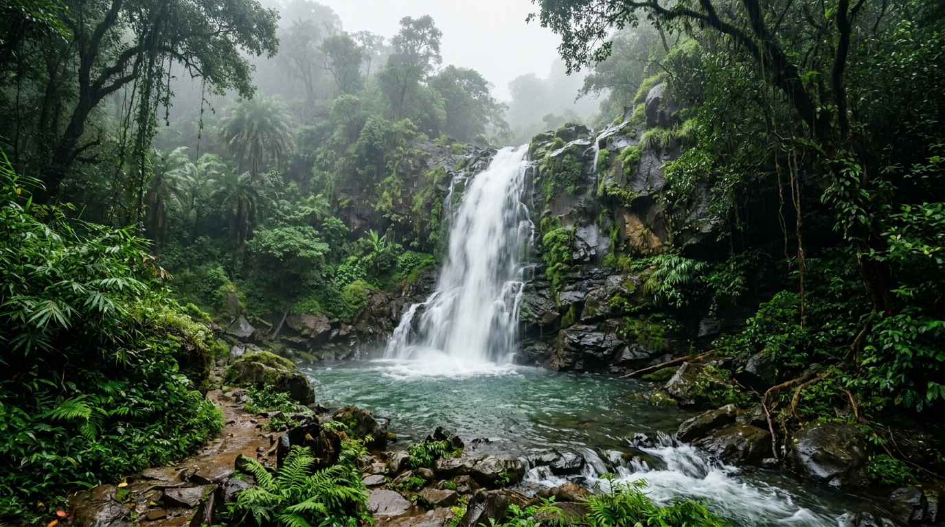
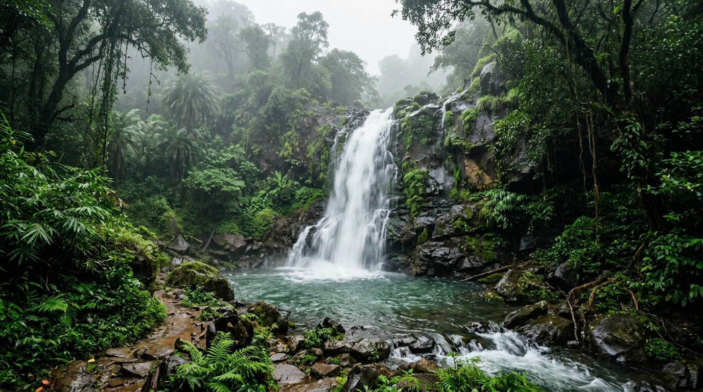
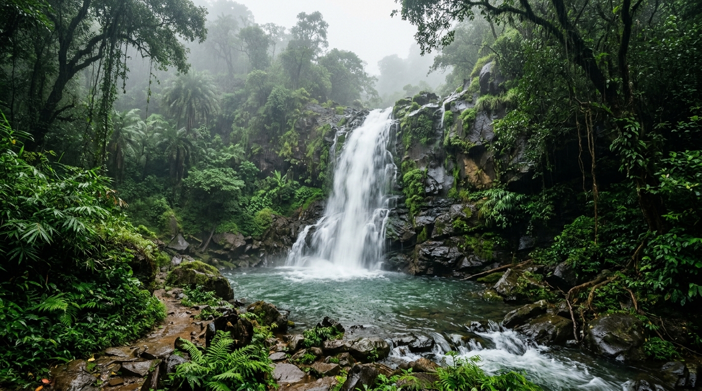
Vajrai Upper Plunge (Bhambavli Vajrai) is one of India's tallest waterfalls, plunging 560 meters in three spectacular tiers into Urmodi River gorge near Kas Flower Plateau, 28 km from Satara, Maharashtra. Formed along the Urmodi River, Vajrai Upper Plunge & Urmodi Basin represents one of the most distinctive natural features of Satara district in Maharashtra. Falling across an estimated vertical drop of 560 Meters (1837 Feet), it offers travelers a pristine riparian habitat, dramatic seasonal hydrodynamics, and a tranquil natural escape.
1. Overview & Landscape Character
Vajrai Upper Plunge & Urmodi Basin stands as an integral natural landmark within the diverse topographical landscape of Satara district in Maharashtra. Fed by the currents of the Urmodi River, the waterfall traverses ancient bedrock formations before plunging across a documented elevation change of 560 Meters (1837 Feet).
The surrounding environment features a rich juxtaposition of forested slopes, moist riverine microclimates, and rugged rock faces. Unlike overcrowded commercial resorts, this location preserves an authentic wilderness character, allowing travelers to experience the natural acoustics of rushing water amidst pristine tree canopies.
Whether explored during the peak flow of the monsoon or during the calm clarity of the post-monsoon months, the site offers visitors an intimate encounter with the riparian geography of the region, managed under the administrative guidance of the Maharashtra Tourism Development Corporation.
2. Geological Formation & River Hydrology
The morphological structure of Vajrai Upper Plunge & Urmodi Basin is dictated by the underlying petrology of Maharashtra's geological formations. The riverbed of the Urmodi River cuts through alternating strata of resistant crystalline rock and more erodible underlying layers. Over geological epochs, hydraulic headward erosion has carved a pronounced knickpoint where the river abruptly leaps from its upper valley into a lower gorge.
The force of the falling water has hollowed out a sizable plunge pool at the base of the cascade. Differential joint weathering along the rock scarp creates stepped platforms and secondary plunge ledges that disperse the water into mist veils during periods of high volumetric discharge.
3. Documented History vs Local Traditions
When studying Vajrai Upper Plunge & Urmodi Basin, it is essential to distinguish between documented historical records and oral folklore passed down across generations in Satara district:
Documented Administrative & Regional History
Archival district gazetteers and regional forest administration records reference the catchment of the Urmodi River as an important riparian corridor used historically by local agrarian and forest-dwelling communities. In modern administrative history, the area has been recognized for its hydrological importance in maintaining soil moisture and feeding downstream agricultural basins.
Local Traditions & Cultural Folklore
In local folk memory, the cascade and its surrounding forest clearings are often associated with indigenous seasonal festivals, forest guardian shrines, and pastoral legends. While these oral narratives enrich the cultural identity of Satara, they are celebrated as living cultural heritage rather than scientifically documented historical occurrences.
4. Flora, Fauna & Forest Ecosystem
The microclimate sustained by Vajrai Upper Plunge & Urmodi Basin fosters a vibrant botanical and zoological habitat. The constant moisture plume supports lush evergreen undergrowth, epiphytic orchids, wild ginger varieties, and dense riverine canopies consisting of native broadleaf timber species.
Avian biodiversity in the vicinity is notably diverse; birdwatchers frequently record kingfishers, flycatchers, drongos, and predatory raptors soaring along the river canyon. Amphibians and freshwater crustaceans thrive within the gravel beds and calm backwaters of the Urmodi River, while surrounding wooded corridors provide foraging ground for civets, macaques, and native deer.
5. Seasonal Flow & Month-by-Month Matrix
The flow volume of Vajrai Upper Plunge & Urmodi Basin undergoes dramatic seasonal transformations dictated by regional monsoon patterns and subsequent winter dry seasons:
| SEASON / PERIOD | FLOW CONDITION & CHARACTER | WATER CLARITY | ACCESS & TREK SAFETY |
|---|---|---|---|
| Monsoon (June – September) | Maximum roar, full width, heavy spray clouds | Turbid, rich in mountain sediment | Caution required; slippery rocks and high currents |
| Post-Monsoon (October – January) | Optimal balanced volume, stable scenic flow | High clarity, crystal clear pools | Best travel window; ideal trail stability |
| Winter (February – March) | Gentle, segmented cascades over rock ledges | Exceptional clarity, calm water levels | Pleasant daytime weather, very safe trails |
| Summer (April – May) | Reduced stream flow, exposed geological bedrock | Clear shallow pools in rock basins | Warm conditions; ideal for geological study |
6. Access & Transport Logistics
Reaching Vajrai Upper Plunge & Urmodi Basin in Satara district is straightforward with well-planned regional connections across air, rail, and road networks:
- By Air: The nearest operational airport provides scheduled commercial connections. From the airport terminal, travelers can hire private taxis or board state transport buses toward Satara district headquarters.
- By Rail: The regional railway junction serves as the primary railhead, connecting to major state transport lines. Taxis, shared jeeps, and local buses ply regularly between the station and nearby town centers.
- By Road: State highways and well-maintained district roads connect Satara with neighboring hubs. Private vehicles and self-drive cars can navigate close to the trailhead parking area.
- Trail Approach: From the vehicle parking point, a designated walking trail leads travelers through shaded forest greenery directly to the main waterfall viewing deck.
7. Permits, Entry Regulations & Timings
Visitor entry to Vajrai Upper Plunge & Urmodi Basin is managed in accordance with state tourism and forest department guidelines:
- Visiting Hours: Generally open from 08:00 AM to 05:30 PM. Entry after dusk is strictly prohibited for wildlife protection and visitor safety.
- Entry Fees & Permits: Nominal entry or parking fees may be collected by local village tourism committees or forest checkpoints to support site maintenance and clean-up operations.
- Restricted Items: Single-use plastic bags, alcohol, fireworks, and loud music equipment are prohibited within the waterfall conservation zone.
8. Photography & Lighting Manual
Capturing the dramatic drop and misty atmosphere of Vajrai Upper Plunge & Urmodi Basin requires careful attention to natural lighting and moisture protection:
- Optimal Lighting Hours: Early morning (07:30 AM – 10:00 AM) and late afternoon (03:30 PM – 05:00 PM) provide soft directional lighting that minimizes harsh granite reflections.
- Long Exposure Techniques: Use a neutral density (ND8 or ND16) filter and a sturdy tripod to achieve smooth, silky water ribbons without overexposing the white foam.
- Spray Protection: Keep a microfiber cleaning cloth and lens rain cover handy, as wind shifts can carry fine mist onto camera optics.
- Drone Regulations: Unmanned aerial vehicles (drones) require prior permission from local district authorities and must never be flown close to roosting forest birds or fellow travelers.
9. Safety Hazards & Water Guidelines
Follow all advisory signboards erected by the forest administration, wear footwear with deep-tread rubber outsoles, and keep children under close supervision at all times along the trail.
10. Packing Essentials & Field Gear
Ensure you carry appropriate day-pack equipment for an enjoyable and safe visit:
- Trekking shoes or trail sandals with non-slip grip soles
- Waterproof rain poncho or lightweight windbreaker jacket
- Reusable stainless-steel water bottle (refuse single-use plastic)
- Dry-bag pouch for mobile phones, cameras, and identity documents
- Basic first-aid kit with antiseptic wipes and adhesive bandages
- Natural eco-friendly insect repellent lotion for forest walks
11. Nearby Waterfalls & Regional Circuit
Enhance your travel itinerary across Satara and Maharashtra by exploring these closely related waterfalls within the same geographic and river corridor:
12. Responsible Tourism & Conservation
The ecological health of Vajrai Upper Plunge & Urmodi Basin and the Urmodi River depends upon conscious, responsible visitation by every traveler. Hidden Routes is committed to zero-trace exploration:
- Carry Out All Waste: Every wrapper, bottle, and organic scrap must return with you to designated municipality bins in town.
- Respect Wildlife: Keep noise levels low, do not feed forest primates, and observe nesting birds from a respectful distance.
- Support Local Economy: Purchase refreshments, seasonal forest honey, and local fruit from rural vendors near the parking entrance to directly support indigenous livelihoods.
13. Sources & Authoritative References
The factual data, hydrological details, and geographic boundaries documented in this guide are cross-verified through authoritative institutional resources:
- Maharashtra Tourism Development Corporation Official Portal — Ecotourism destination records and visitor regulations.
- Maharashtra Forest Department Regional Working Plans — Flora, fauna, and catchment conservation data for Satara district.
- Geological Survey of India (GSI) State Bulletins — Regional petrology and drainage basin morphological surveys.
- District Administration Gazetteer of Satara — Historical infrastructure, transport routes, and demographic data.
14. Research & Editorial Transparency
This comprehensive guide to Vajrai Upper Plunge & Urmodi Basin is published as part of the Hidden Routes Field Research Initiative. Our editorial desk continuously tracks changes in road access, forest department permit policies, seasonal flow conditions, and safety advisories across all districts of Maharashtra.
If you have recent field updates, trail observations, or administrative notices regarding Vajrai Upper Plunge & Urmodi Basin, please connect with our editorial team to help keep this travel knowledge base accurate and helpful for all travelers.
15. Frequently Asked Questions (FAQ)
Common questions answered regarding trip planning, seasonality, logistics, and safety for Vajrai Upper Plunge & Urmodi Basin:
Located near Bhambavli village, 28 km from Satara city near Kas Plateau.
Drops 560 meters (1,837 feet) in three steps, one of India's highest waterfalls.
Urmodi River.
Drive along Satara-Kas road, turning off at Bhambavli (approx 50 mins drive).
August to December during and after monsoon season.