Lodh Falls
"The 143-Meter Sovereign Cataract — Highest Waterfall in Jharkhand"
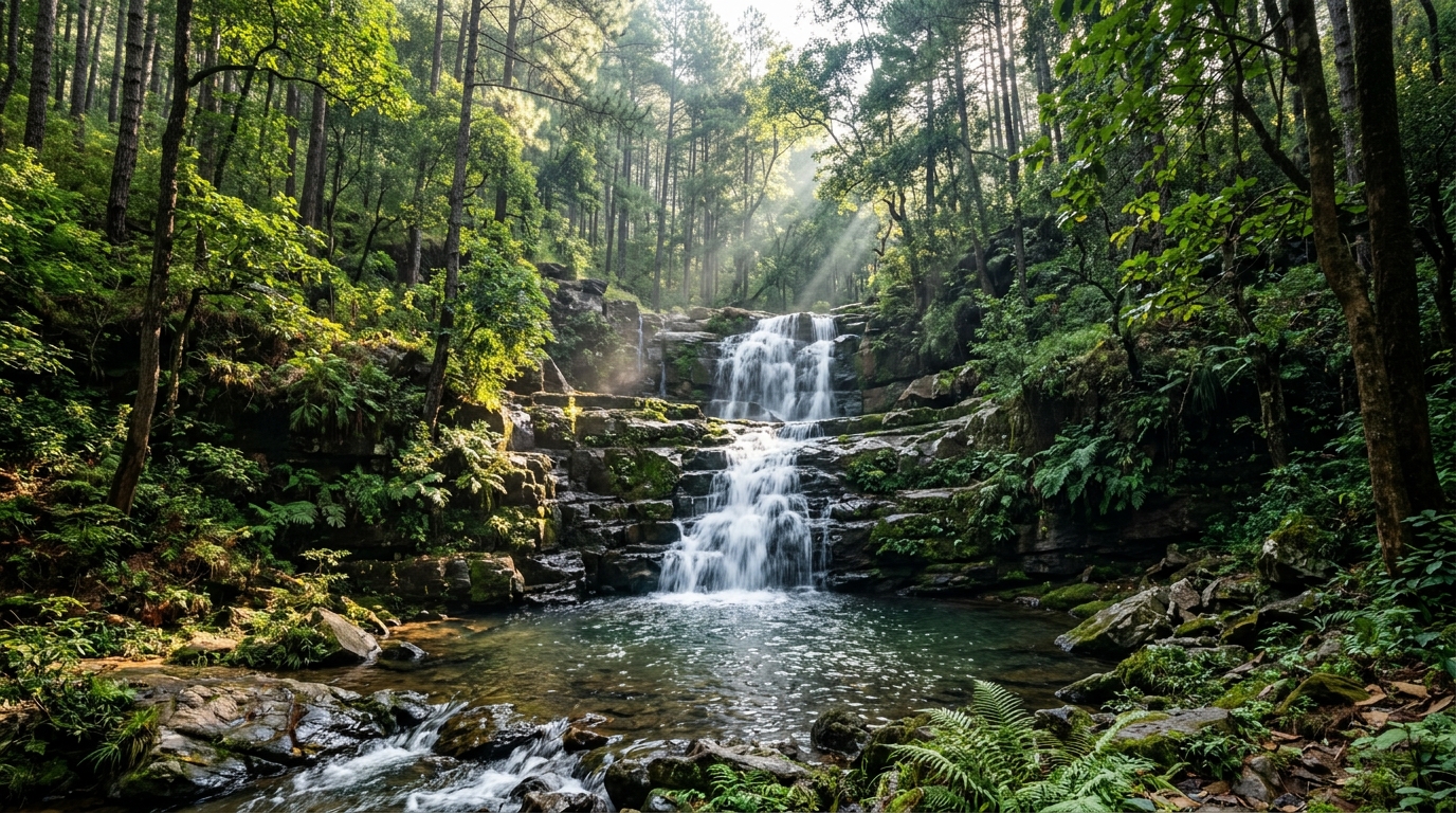
Lodh Falls (also known as Burha Ghagh) is a monumental 143-meter (469 feet) tiered mountain waterfall situated on the Burha River in Mahuadanr Block, Latehar District, Jharkhand. Officially recognized as the tallest waterfall in Jharkhand and the 21st highest in India, Lodh descends through the pristine, wildlife-rich forests of the western Chota Nagpur Plateau adjacent to the Palamu Tiger Reserve corridor and Netarhat hills.
1. Overview, Topography & Identity
Dominating the dense, roadless wilderness of western Jharkhand with unparalleled vertical scale, Lodh Falls (locally revered as Burha Ghagh) is the tallest waterfall in the state and one of the most majestic cataracts in eastern India. Located in Mahuadanr block of Latehar district, the cataract is formed where the perennial Burha River hurtles 143 vertical meters (469 feet) across multiple stepped tiers into a deep, primeval forest amphitheater.
The High Pats Plateau & Sal Wilderness
The journey to Lodh traverses the remote highlands of the Netarhat Plateau (known as the *Pats* region), rising above 1,000 meters elevation. The approach winds through dense old-growth sal (*Shorea robusta*) forests, towering bamboo brakes, and pristine tribal villages populated by the **Birhor**, **Asur**, and **Oraon** indigenous peoples. The thunder of 143 meters of falling water reverberates up to 10 kilometers across the silent mountain valleys during the monsoon.
Indigenous Asur Heritage & Ancient Metallurgy
The high plateau ridges around Mahuadanr and Netarhat are the ancestral homeland of the **Asur tribe**, recognized as one of India's Particularly Vulnerable Tribal Groups (PVTGs). Renowned since the Vedic era for their mastery of indigenous iron smelting using charcoal from sal wood and local iron-ore nodules, the Asur people maintain deep spiritual traditions that venerate the mountain rivers and waterfalls as living ancestral guardians.
1. Overview, Topography & Identity
Dominating the dense, roadless wilderness of western Jharkhand with unparalleled vertical scale, Lodh Falls (locally revered as Burha Ghagh) is the tallest waterfall in the state and one of the most majestic cataracts in eastern India. Located in Mahuadanr block of Latehar district, the cataract is formed where the perennial Burha River hurtles 143 vertical meters (469 feet) across multiple stepped tiers into a deep, primeval forest amphitheater.
The High Pats Plateau & Sal Wilderness
The journey to Lodh traverses the remote highlands of the Netarhat Plateau (known as the *Pats* region), rising above 1,000 meters elevation. The approach winds through dense old-growth sal (*Shorea robusta*) forests, towering bamboo brakes, and pristine tribal villages populated by the **Birhor**, **Asur**, and **Oraon** indigenous peoples. The thunder of 143 meters of falling water reverberates up to 10 kilometers across the silent mountain valleys during the monsoon.
2. Geology: 143m Western Escarpment Tiered Knickpoint
The geological architecture of Lodh Falls is carved out of the ancient Archaean crystalline basement and Dharwar metavolcanics of the Chota Nagpur highland rim, dating back over 2.7 billion years.
Multi-Tiered Escarpment Geomorphology
The waterfall is formed as the Burha River descends from the elevated Netarhat laterite plateau to the lower North Koel river basin. The river plunges across three major structural steps in the granite-gneiss bedrock. The massive upper drop leaps clear of the cliff edge, cascading onto wide, stepped stone ledges before consolidating into a final sheer plunge into the deep forest gorge.
3. Burha River Hydrology & Ancient Forest Lore
The Burha River holds deep cultural reverence in indigenous folklore:
The 'Burha Ghagh' (Old River Plunge) Heritage
In the local tribal dialect, Burha signifies "ancient" or "venerated elder", while Ghagh means "waterfall". According to indigenous lore, the river has flowed uninterrupted through these ancient hills since the dawn of creation, serving as a sacred life source for tribal forest dwellers who offer ritual prayers to the water deities (*Chandi Bonga*) during seasonal hunting and gathering cycles.
4. Palamu Corridor Ecology & Mahuadanr Wolf Sanctuary
Lodh Falls is located within one of India's most critical wildlife conservation landscapes:
Mahuadanr Wolf Sanctuary (India's Premier Canid Reserve)
Located in the broad river valley adjacent to Lodh Falls, the **Mahuadanr Wolf Sanctuary** (notified in 1976) spans 63 square kilometers and represents India's only dedicated wildlife sanctuary established specifically for the protection and breeding of the endangered Indian Grey Wolf (Canis lupus pallipes). The rocky limestone crevices, rolling grasslands, and scrub forests provide ideal denning grounds for wolf packs that hunt small prey across the valley.
Palamu Tiger Reserve Forest Corridor
The dense sal forest canopy around the waterfall forms an essential contiguous wildlife corridor connecting the Palamu Tiger Reserve with the Guru Ghasidas (Sanjay) National Park in neighboring Chhattisgarh, supporting free-ranging herds of Asian wild elephants, leopards, sloth bears, gaur (Indian bison), chital, and barking deer.
4. Palamu Corridor Ecology & Mahuadanr Wolf Sanctuary
Lodh Falls is located within one of India's most critical wildlife conservation landscapes:
- Mahuadanr Wolf Sanctuary: Located in the valley adjacent to Lodh Falls, this is India's only dedicated wildlife sanctuary established specifically for the conservation of the endangered Indian Grey Wolf (Canis lupus pallipes).
- Palamu Tiger Reserve Corridor: The dense sal forest canopy around the waterfall forms an essential migratory corridor for Asian wild elephants, leopards, sloth bears, gaur (Indian bison), and sambar deer moving between Jharkhand and Chhattisgarh.
5. Observation Terraces & Railed Promenade Navigation
The Jharkhand Forest Department has developed safe viewing platforms:
- Main Railed Forest Balcony: Positioned across the gorge from the 143-meter plunge, this stone viewing deck provides an unobstructed panoramic view of all three cascading tiers framed by green mountain cliffs.
- Lower Riverside Trail: A gentle 500-meter walking path through bamboo groves leading toward the boulder-strewn banks of the Burha River downstream from the plunge pool.
6. Seasonal Hydrodynamics & Month-by-Month Matrix
Discharge at Lodh is shaped by the heavy monsoon rains over the Netarhat hills:
| SEASON / PERIOD | WATERFALL PROFILE & VOLUME | FOREST ROAD ACCESSIBILITY | TRAVEL VERDICT |
|---|---|---|---|
| September – November (Post-Monsoon) | Colossal roaring triple-tier deluge; massive spray clouds | Forest roads open and dry | Best overall visit window; peak volume & clear skies |
| December – February (Winter) | Clean, high-volume white plunge; crisp mountain air | Fully accessible | Optimal for landscape photography & Netarhat hill station trip |
| March – May (Summer) | Slender cascade; exposed granite rock strata | Accessible; warm forest trails | Offbeat wildlife visit; wolf tracking season |
| June – August (Peak Monsoon Deluge) | Apocalyptic roaring flood; deafening acoustic roar | Challenging road transit; heavy rain showers | High adventure; sturdy vehicle mandatory |
7. Comprehensive Transit: Netarhat, Mahuadanr, Daltonganj & Ranchi
Lodh Falls is reached via scenic mountain road corridors through the rugged highlands of western Jharkhand:
Driving Route & Approach Navigation
- From Netarhat Hill Station (60 km / ~1.5 hours): Descend the winding Netarhat Ghat pass toward the Mahuadanr valley along the paved state highway. From Mahuadanr town, follow the well-surfaced rural forest road heading southwest for 14 km directly to the Lodh Falls forest entrance gate.
- From Latehar District Headquarters (130 km / ~3 hours): Drive southwest via Garu and Mahuadanr traversing the scenic buffer forests of the Palamu Tiger Reserve.
- From Ranchi State Capital (195 km / ~4.5 hours): Follow National Highway 143A (NH 143A) through Lohardaga, Gumla, and climb up to Netarhat before descending into Mahuadanr.
Railway & Aviation Connectivity
The nearest primary railheads are Daltonganj Railway Station (DTO) (120 km) on the Eastern Railway mainline and Latehar Railway Station (LTHR) (130 km). Birsa Munda Airport (IXR) in Ranchi (195 km) is the primary aviation facility with direct flights across India.
7. Comprehensive Transit: Netarhat, Mahuadanr, Daltonganj & Ranchi
Lodh Falls is reached via scenic mountain road corridors through western Jharkhand:
Driving Route & Highway Navigation
- From Netarhat Hill Station (60 km / ~1.5 hours): Descend the scenic Netarhat Ghat pass toward Mahuadanr, then follow the paved rural forest road directly to the Lodh Falls entrance gate.
- From Latehar District Center (130 km / ~3 hours): Drive southwest via Garu and Mahuadanr through the Palamu forest corridor.
- From Ranchi State Capital (195 km / ~4.5 hours): Follow National Highway 143A (NH 143A) through Gumla and Netarhat.
Railway & Aviation Access
The nearest primary railway stations are Daltonganj Railway Station (DTO) (120 km) and Latehar Railway Station (LTHR) (130 km). Birsa Munda Airport (IXR) in Ranchi (195 km) is the primary airport.
8. Forest Department Regulations, Tariffs & Timings
Visitor infrastructure is managed by the Latehar Forest Division:
| SERVICE / FACILITY CATEGORY | OFFICIAL TARIFF | OPERATIONAL DETAILS |
|---|---|---|
| Adult Entry Ticket | ₹20 per person | Forest eco-development entry pass |
| Children (Under 10 years) | ₹10 per child | Must be accompanied by adult guardians |
| Four-Wheeler Parking | ₹30 per car | Designated parking area near gate |
| Two-Wheeler Parking | ₹15 per motorcycle | Designated parking bays |
| Operating Hours | 06:00 AM – 05:00 PM | Strict entry closure after 04:30 PM |
9. Professional Photography & Multi-Tier Framing Manual
Capturing the monumental 143-meter vertical drop of Lodh requires telephoto and wide-angle techniques:
- Telephoto Compression (70-200mm): From the main observation deck across the canyon, use a telephoto lens to compress the three cascading tiers into a single dynamic frame, highlighting the vertical power against green forest cliffs.
- Morning Sunlight Alignment: The waterfall face is illuminated by clear frontal sunlight between 08:30 AM and 11:30 AM.
- Polarizing Filters: Use a Circular Polarizer (CPL) to cut water glare on the wet granite ledges and deepen the rich green tones of the surrounding sal forest.
10. Critical Safety Warnings & Deep Forest Directives
- Stay on Designated Decks: Always view the cataract from authorized Forest Department platforms.
- Daylight Driving: Due to remote forest terrain, ensure your return journey departs before dusk (04:30 PM).
11. The Western Jharkhand Wilderness Circuit: Netarhat & Betla
Lodh is the centerpiece of western Jharkhand's premier ecotourism trail:


12. Palamu Tiger Reserve Corridor Stewardship & Rules
The Burha river basin is a vital lifeline for endangered wildlife across the Palamu biosphere. The Forest Department strictly enforces a zero-plastic and zero-littering policy. Visitors must keep noise to a minimum, refrain from feeding wild animals, and support local tribal eco-guides from Mahuadanr.
13. Frequently Asked Questions (FAQ)
Lodh Falls has a vertical drop of 143 meters (469 feet). It is officially the tallest waterfall in Jharkhand and the 21st highest waterfall in India.
Lodh Falls is formed by the Burha River (hence the alternate name Burha Ghagh), an important tributary of the North Koel River draining the western Chota Nagpur highlands.
Lodh Falls is located approximately 60 km southwest of Netarhat hill station and 195 km west of Ranchi in Mahuadanr block, Latehar district, Jharkhand.
The ideal time to visit is from September to February (post-monsoon and winter) when the Burha River flows with massive volume and the forest approach roads are clear.
Yes, Lodh Falls is situated within the dense sal and bamboo forest corridor adjacent to the Palamu Tiger Reserve buffer and Mahuadanr Wolf Sanctuary.
Lodh Falls is open daily from 06:00 AM to 05:00 PM. The Forest Department entry ticket is ₹20 per adult, with vehicle parking fees of ₹30 for four-wheelers.