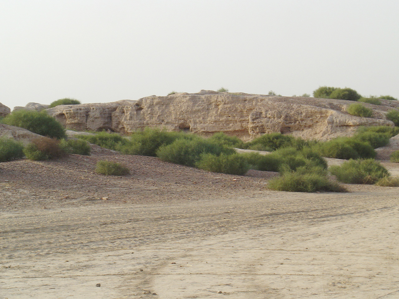
1. Overview & Archaeological Significance
Kalibangan, meaning literally 'black bangles' in Rajasthani (named after the dense carpet of weathered terracotta and faience bangles covering the mound surface), is a legendary archaeological site situated on the left bank of the dry bed of the seasonal Ghaggar (ancient Saraswati) river in the Hanumangarh district of northern Rajasthan. Spanning two prominent mounds (KLB-1 and KLB-2), the site represents a crucial evolutionary link between the Early Harappan (Sothi-Siswal cultural phase, c. 3000–2600 BCE) and the fully matured urban phase of the Indus Valley Civilization (c. 2600–1900 BCE).
Located in the Hanumangarh district of Rajasthan, Kalibangan Harappan Site is centrally protected by the Archaeological Survey of India (ASI) as an irreplaceable landmark of South Asian civilization. Recognized for its mud-brick citadel & lower city, criss-cross ploughed field & row of fire altars, the site provides profound insights into the technological prowess, cosmological beliefs, and cultural aesthetics of its ancient builders.
2. Dynastic Origins, Royal Patrons & Chronology
The site was first identified in 1917 by the Italian Indologist and linguist Luigi Pio Tessitori while surveying bardic chronicles in Bikaner State. Between 1960 and 1969, the Archaeological Survey of India mounted extensive, meticulous excavations under the leadership of B.B. Lal and B.K. Thapar. These landmark excavations revealed unprecedented evidence of prehistoric agriculture, seismic disturbances, town fortification, and ritual practices that distinguished Kalibangan from all previously explored Indus metropolises.
One of the most consequential discoveries made by B.B. Lal was stratigraphic evidence of a catastrophic earthquake around 2600 BCE that fractured the Early Harappan mud-brick ramparts and leveled domestic houses, causing a temporary abandonment of the settlement. When the site was reoccupied during the Mature Harappan epoch, the town was rebuilt with expanded dual fortifications, sophisticated street grids, and a dedicated ritual complex centered on sacrificial fire altars.
3. Structural Engineering & Architectural Design
Kalibangan's urban plan comprises two distinct walled compounds: the Western Citadel mound (KLB-1) and the larger Eastern Lower City mound (KLB-2). The Citadel is unique in being partitioned by a central fortified cross-wall into two equal rhomboid enclosures. The Northern Sector contained palatial residential quarters for the civic elite, while the Southern Sector was exclusively dedicated to public and ritual ceremonies, featuring massive mud-brick platforms that elevated religious activities high above the general populace.

Upon these elevated southern platforms stood a row of seven contiguous clay-plastered fire altars. Each altar consisted of an oblong pit sunken into the brick floor, containing a central cylindrical clay stele surrounded by charcoal, ash, and terracotta briquettes used to retain heat. Beside the altars stood a brick well and bathing platforms, indicating preliminary ritual ablutions performed before sacrificial offerings, providing profound architectural parallels to later Vedic fire rituals.
The Lower City was enclosed by its own massive mud-brick perimeter wall and laid out on an orthogonal grid with four principal north-south streets and several intersecting east-west alleys. Uniquely, the width of the streets followed an exact arithmetic progression: alleys were 1.8 metres wide, secondary streets 3.6 metres, main avenues 5.4 metres, and principal thoroughfares 7.2 metres, demonstrating a rigid municipal planning code. Houses were entered from side lanes rather than main streets to ensure privacy and minimize road dust.
4. Archaeological Excavations, Epigraphy & Conservation
The single most celebrated archaeological discovery at Kalibangan occurred just outside the southern perimeter of the Early Harappan settlement: the world's earliest attested ploughed agricultural field, dated to circa 2800 BCE. The field preserved fossilized intersecting furrow marks laid out in a precise grid pattern. The closer furrows (spaced 30 cm apart) ran east-west, while the wider furrows (spaced 1.9 metres apart) ran north-south—a dual-cropping method identical to that still practiced by modern Rajasthani farmers cultivating mustard and gram simultaneously.
Excavations also unearthed the famous 'Kalibangan cylinder seal' of Mesopotamian type, depicting a composite half-human half-tiger deity flanked by two standing warriors, confirming long-distance commercial interaction with Sumerian cities. The cemetery situated 200 metres west of the town revealed three distinct burial types: extended inhumation in rectangular brick graves, circular pit burials containing funerary urns without skeletal remains, and rectangular pot-burials, illustrating pluralistic cultural traditions.
Thousands of terracotta bangles, steatite beads, gold ornaments, copper axes with cast blades, bone styluses, and inscribed clay sealings were salvaged from domestic rooms, along with pottery showing distinctive Sothi painted motifs: black-painted horned deities, peacocks, fish scales, and pipal leaves on a dull red slipped surface.
Kalibangan is a Centrally Protected Monument under the Archaeological Survey of India (Jaipur Circle). Entry to the archaeological mounds and the on-site ASI museum is free of charge for all visitors. Visitors must register their details at the security kiosk near the museum entrance.
5. Master Highlights & Archaeological Marvels
Visitors exploring Kalibangan can view the excavated southern citadel platform with its preserved brick fire altars, the communal well, and the fortified bastions. Standing on KLB-1, one can clearly trace the wide depression of the dry Ghaggar riverbed where perennial waters once flowed.

In the Lower City (KLB-2), the street grid remains clearly distinguishable with room walls standing several courses high. Wooden drainage chutes, vertical terracotta pipes, and large earthenware soakage jars embedded into house floors highlight Harappan sanitation engineering.
Informational signage erected by the ASI guides visitors across the primary excavation trenches, highlighting the seismic fault fissures visible in the Early Harappan strata and the perimeter fortification gates.
6. Visiting Hours, Entry Permits & Visitor Guidelines
The archaeological site of Kalibangan is open to the public daily from sunrise to sunset (approximately 6:00 AM to 6:00 PM). The on-site Kalibangan Archaeological Site Museum is open from 10:00 AM to 5:00 PM, closed every Friday.
There are no entry fees for visiting either the open archaeological mounds or the ASI museum. Ample vehicle parking is available near the entrance gate and museum lawn.
Visitors must not walk upon or step across the ancient mud-brick wall alignments. Collecting pottery pieces, terracotta bangle fragments, or bone fossils from the ground is strictly illegal under the AMASR Act.
Photography is permitted for personal use; commercial filming and drone operation require prior written permits from the ASI Jaipur Circle and district authorities. Visitors must carry hats, sunscreen, and plenty of drinking water, as the desert climate causes severe dehydration.
Kalibangan's sun-dried mud bricks are exceptionally sensitive to foot erosion and climatic weathering. Please remain strictly on marked visitor paths. Vandalism, digging, or artifact removal will result in prosecution under the AMASR Act.
7. Site Museum & Interpretation Centers
The Kalibangan Archaeological Museum, set up by the ASI in 1983 on the monument grounds, displays an exceptional array of antiquities excavated across the two mounds. The collection is arranged chronologically into Early Harappan (Period I) and Mature Harappan (Period II) galleries.
Key museum exhibits include the famed cylindrical terracotta seals, shell bangles, bone points, copper celts, multi-colored steatite beads, terracotta bull figurines, and a photographic replica of the famous 2800 BCE ploughed field. Closed on Fridays.
8. Climate, Best Seasons & Ideal Visiting Hours
The best time to visit Kalibangan is during the cool winter season from November to February, when temperatures average 14°C to 24°C, providing comfortable conditions for exploring the open-air desert ruins.
Summer months from April to June are scorching, with temperatures often crossing 46°C accompanied by intense desert dust storms. The brief monsoon (July to August) brings occasional rain, but the unpaved approach roads can become muddy.
9. Transit Logistics, Rail, Air & Road Access
Kalibangan is located in Pilibanga tehsil of Hanumangarh district in northern Rajasthan, roughly 30 kilometres south of Hanumangarh town, 50 kilometres northeast of Suratgarh, and 205 kilometres northeast of Bikaner.
The nearest railway station is Pilibanga (5 km away), connected by passenger and express trains on the Suratgarh–Hanumangarh line. Suratgarh Junction (50 km) and Hanumangarh Junction (30 km) have broad connectivity to Delhi, Jaipur, Jodhpur, and Bathinda. The nearest commercial airport is Bikaner (Nal Airport, 215 km) or Sri Ganganagar (90 km).
10. Regional Heritage Circuits & Sibling Monuments
Kalibangan forms part of the Northern Rajasthan Desert & Ghaggar Valley Heritage Trail:
Sacred Architecture & Darshan Protocol Guide
Maximize your spiritual journey: VIP vs Sugam Darshan line reality, locker rules, and historical truth.
- ✓Sugam Darshan & Token Blueprint: Accurate online booking rules, pre-dawn passes, and entry lane realities.
- ✓Zero Commercialization Guard: Avoid bogus intermediaries, fake priest fees, and paid blessing scams.
- ✓Locker, Footwear & Mobile Safety: Verified cloakroom locations, authorized phone lockers, and security rules.
- ✓Hidden Architectural Marvels: Inscriptions, subterranean sanctums, and forgotten stone carvings.
🛡️ Personally curated by PK Gupta & the Hidden Routes research desk. Delivered directly to your Email & WhatsApp within 4–8 hours.
11. Frequently Asked Questions
What is the most famous archaeological discovery made at Kalibangan?
The most famous discovery is the world's earliest known ploughed agricultural field, dated to circa 2800 BCE. It preserved criss-cross furrow patterns indicating a dual-cropping system of mustard and gram, identical to practices still used today.
What do the fire altars found at Kalibangan signify?
The row of seven brick-lined fire altars on the southern citadel platform indicates dedicated community fire rituals involving animal offerings and ceremonial ablutions, providing striking architectural parallels to Vedic fire sacrifices.
What does the name 'Kalibangan' mean?
Kalibangan translates to 'black bangles' in Rajasthani (Kali = black, Bangan = bangles), named because the mound was strewn with thousands of fragmented ancient terracotta and blackened faience bangles when first surveyed.
What are the visiting hours and entry fees for Kalibangan?
The ruins are open daily from sunrise to sunset with free entry. The on-site ASI Archaeological Museum is open from 10:00 AM to 5:00 PM, closed on Fridays, also with free entry.
How can I travel to Kalibangan from Bikaner or Jaipur?
Kalibangan is 205 km northeast of Bikaner via NH 62 through Suratgarh, taking roughly 4 hours by car. From Hanumangarh, it is just a 30 km drive via Pilibanga.